Piet's Notes on Deep Creek Lake Science
Sensible Technologies - The Science of Deep Creek Lake
From work done in 2012, the bathymetric map of the whole lake, shown in Figure 1, can be used to target a set of coves that we may want to investigate for the impact of freezing temperatures on exposed SAV.
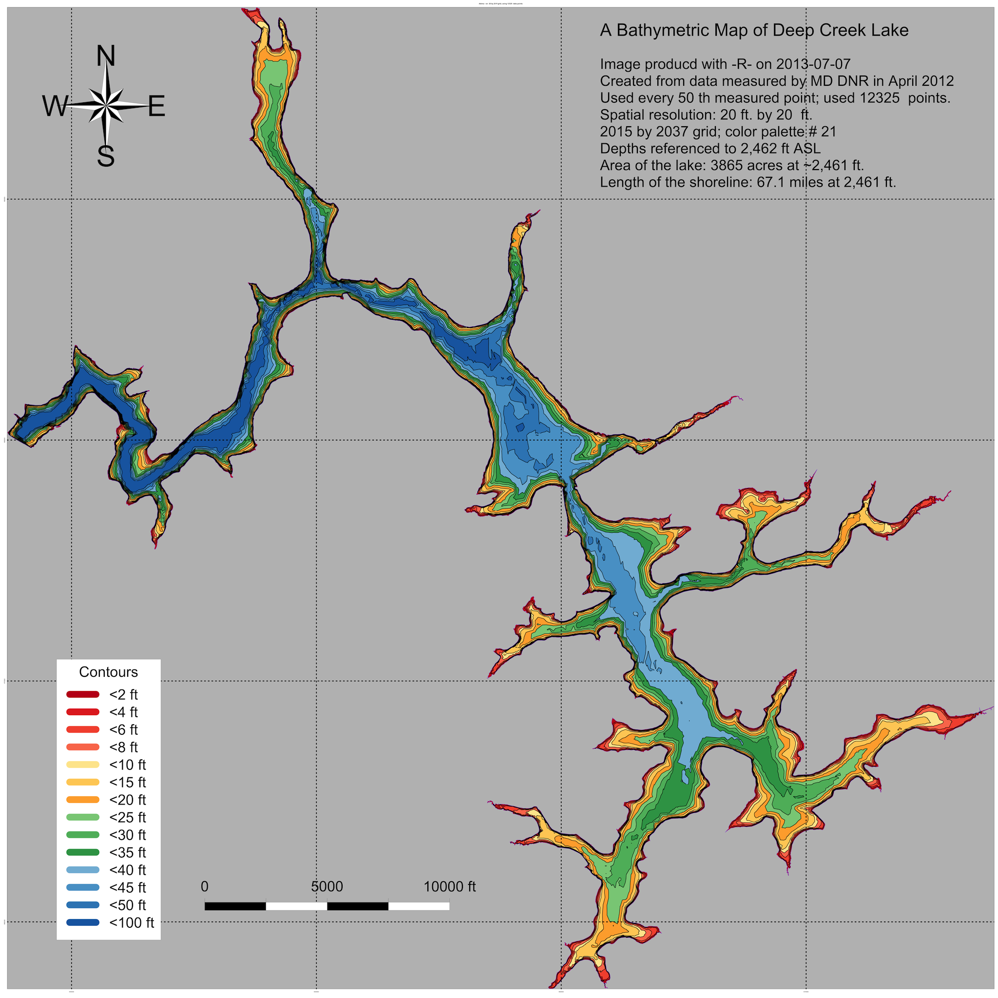
Figure 1 - Bathymetric Map of Deep Creek Lake.
The contours shown on the map in Figure 1 are of lake ‘depths’ in reference to 2462 ft ASL. The lower rule band at 2455 is therefore at a depth of 2462-2455=7 ft. (Note, that, at some point in the future, this map can be recreated to show the lower level contours at 1 ft intervals if needed - it’s time consuming).
As a frame of reference, Figure 2 shows the coves of Deep Creek Lake for which individual detailed bathymetric maps have been created (See Figure 3 for an example of such a more detailed map, here for Hazelhurst Cove).
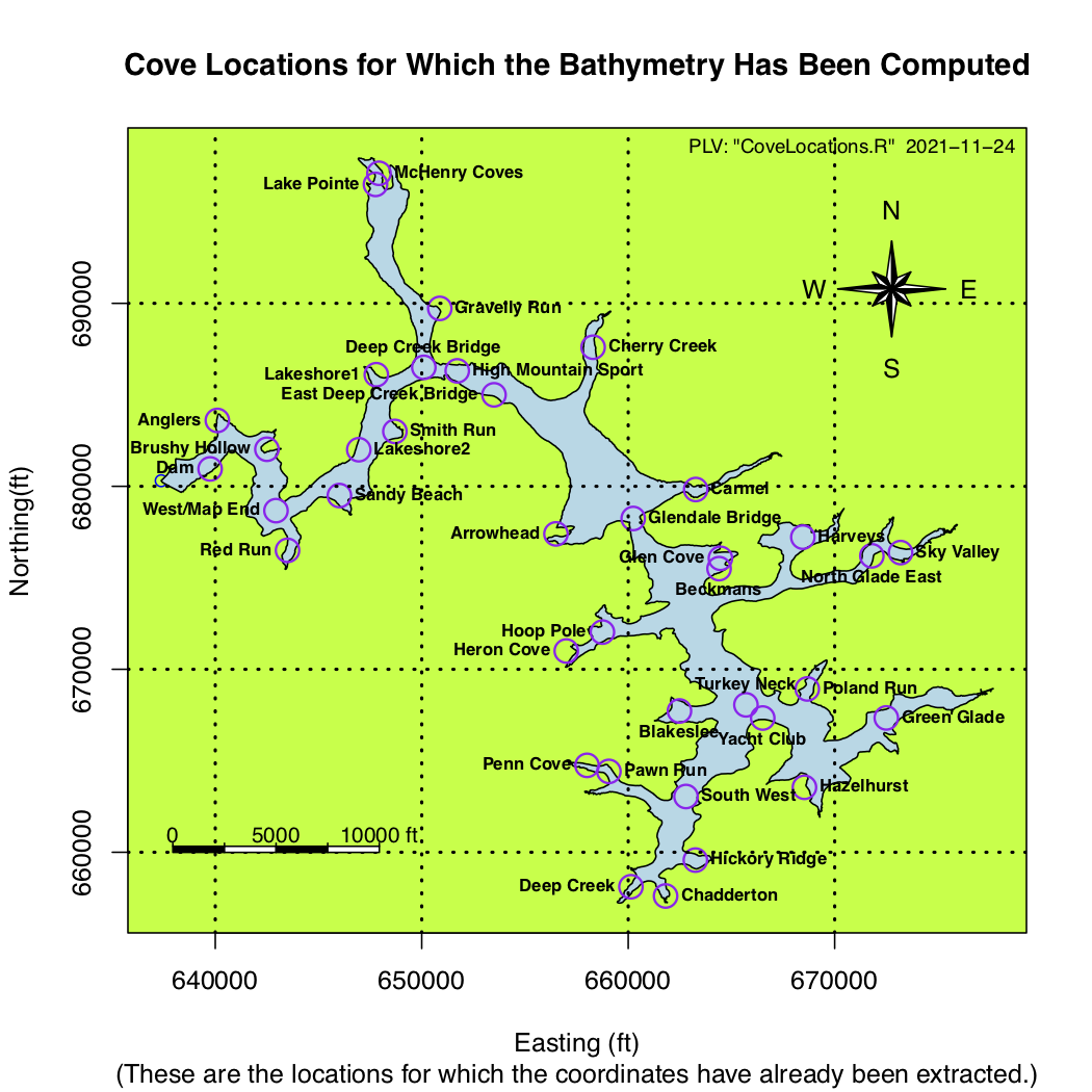
Figure 2 - Coves For Which Detailed Bathymetric Maps Have Been Generated.
From these two images, a set of tentative coves can be identified for further analysis knowing the SAV presence there.
The shallowest areas of the lake are almost all on the southern end of the lake. The following is a tentative list of coves that might be candidates for the SAV study (in alphabetical order):
1. Blakeslee
2. Chadderton
3. Deep Creek Cove
4. Green Glade
5. Harvey’s Cove
6. Hazelhurst
7. Hickory Ridge
8. McHenry Cove
9. Penn Cove
10. Poland Run
Figure 3 is an image of the bathymetry of the Deep Creek Cove, at the very southern end of the lake.
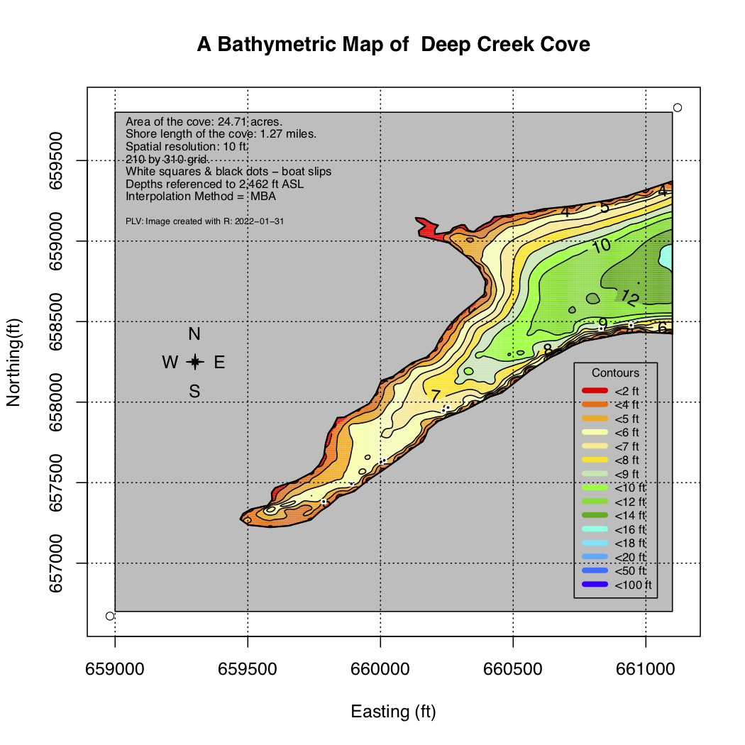
Figure 3 - Bathymetric Map of Hazelhurst Cove.
As can be seen from the legend, the areas that are white are at 2455 ft ASL or above. In this image it’s clear that this cove is pretty shallow.
A clearer image is that of Deep Creek Cove shown in Figure 4. It shows that there is a considerable area exposed to open air when the lake level is at 2455 ft ASL (remember all contours are referenced to 2462 ft as the zero point).
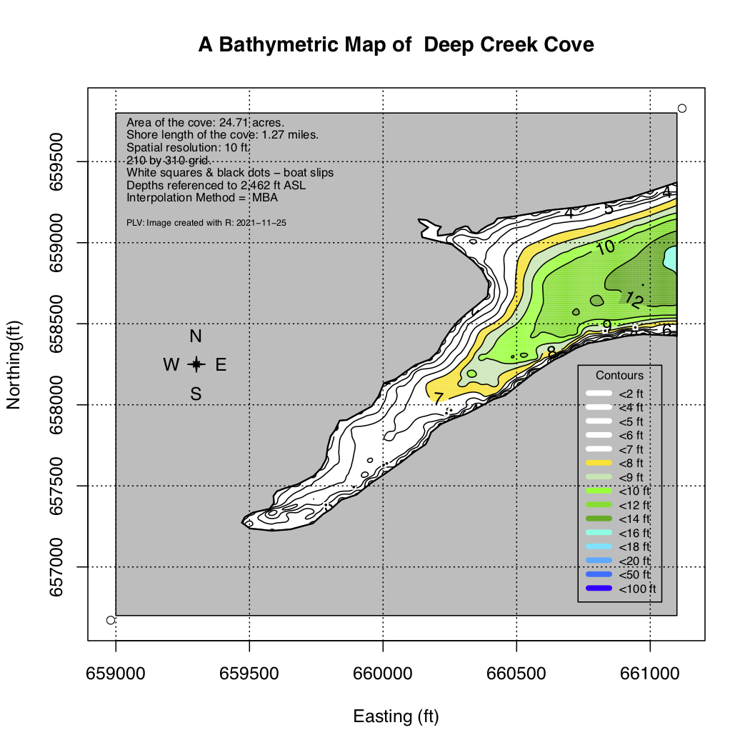
Figure 4 - Bathymetry of Deep Creek Cove
The above are just examples of what can be done with bathymetric maps to narrow down an area and plan for SAV surveys during the winter and summer months.
This is only a very preliminary analysis of how one can narrow down the choice of a cove with existing bathymetric data. The imagery shown dates back to an analysis that was done in the fall of 2012. Maps for selected sub coves can be made but it will take a little time and effort.
These maps would also be interesting to validate the bathymetric analysis methodology.
The best way to move forward is, for those who understand the SAV in the lake, to select the sub-coves for which a more detailed map might be desirable, using guidance from Figures 1 and 2 above.