Piet's Notes on Deep Creek Lake Science
Sensible Technologies - The Science of Deep Creek Lake
On August 7, 2020, the USGS activated a new lake-level gage at Deep Creek Lake. The gage’s description and data is provided here by the USGS.
The datum of the gage is 0.00 ft above North American Vertical Datum of 1988 (NVD 88).
The gage reports results every 15 minutes.
Until then, the only lake level gage was, and still is, operated by Brookfield Power and was located near the dam at the intake of the Deep Creek Hydro Electric Project. The details of the gage are unknown.
Brookfield reports the most recent water level measurement on their website in addition to the number of turbines that are operating at that time. Hence periodic levels are only available from their annual reports, which lists the daily average levels for the year.
The Brookfield measurements are referenced to the height of the spillway which is commonly reported to be at 2462 ft ASL.
The USGS datum for its gage is -1.86 ft below the spillway datum.
According to Morgan France; “During the installation of the gauge at Meadow Mountain Run bridge at the State Park the USGS technicians took a GPS receiver to the dam overflow weir and a benchmark at the gauge site to get the datum equation.”
Figure 1 attempts to compare the two gages. The legend shows what line who the gages belong to.
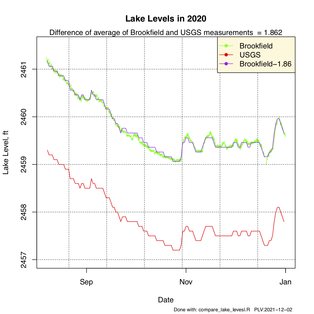
Figure 1 - Comparing Brookfield's and USGS's Gage Measurements
Since both gages attempt to measure the same thing and each has plenty of data, just computing the difference between both average levels for the six month period should provide near the same number for the datum as given above. The chart shows that the calculated difference of the averages is 1.862, which is quite good, given that the USGS gage has a lot of missing points.