Piet's Notes on Deep Creek Lake Science
Sensible Technologies - The Science of Deep Creek Lake
The location of boat slips is an important variable in order to assess the local water depth under a boat as a function of lake level. Some people feel that they have to remove their boats too early in the season(e.g. mid August). There are a number of possible reasons for this. Are their coves accumulating sediment? Is the lake’s water level being mismanaged? Is this the way it is, shallow coves to start with? Or, possibly all of the above?
A sample to see how to go to another page on this site.
For sure, some of the coves have experienced significant sedimentation. Lake levels are dictated by the amount of rain and summer conditions, both of which dictate releases through the hydro-electric generator turbines, for white water releases and Youghiogheny water flows and temperatures. What cannot be overemphasized, however, is that the lake bottom slopes DOWNWARDS, from the southern end of the lake to the northern/north-eastern end, where the old ‘Deep Creek’ merges with the Youghiogheny River.
The only real message appears to be: “Be aware of the depth of the waters around your boat-slip!”
To really be able to do a proper assessment of the water depth beneath a boat requires a good bathymetry of the lake, or at least, the region/area near one’s boat-slip.
I decided to take a stab at identifying what boat slips are located in questionable areas. As the above suggests, there are two parts to the question: “Where is my boat slip located?” and “Will my boat be in the mud in mid-summer?”
The subject of “how deep the waters are” is the topic of several articles elsewhere on this website. Here I like to focus on where boat slips are located and how their locations were determined.
I obtained boat slip files from both DNR and Lake Management but neither had a good perspective on what they actually had (one of DNR’s looks like they had taxcodes associated with boat slip permits) and appeared to be incomplete. They seemed to have been derived from the same common source, a digitization by the County, some time ago, but details of the process and imagery used were unknown.
In preparing this documentation I found that the Google Earth tool that I used in creating the file with 3377 boat slip locations is no longer available, and neither is the imagery that I used, from 7/9/2011 (that’s what I have in my notes)
Google Earth’s imagery, taken on 7/9/2011, was pretty decent because one could discern the locations of most boats and slips around the lake. It appears to be similar to the one that can now be found and labeled as 6/2/2011. Perhaps they are the same, but may have gone through some unknown relabeling process. Both dates of the imageries were close to the height of the season, so one could figure to see pretty much all of the slips/boats in the lake in both.
As an example that the locations of boat slips could still be determined in the way I did this in 2012, I found imagery from 9/5/2013 that is quite clear, although a bit late in the season, with what appears, a fairly complete boat slip set. I developed the following new procedure to extract the location of the center of a boat slip:
Google Earth (Version: 7.1.8.3036 (32-bit)) has several tools that one could use for working working with the maps. They are in the upper left hand corner, as shown in Figure 1. I used the “Add Path” tool.
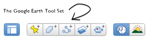
Figure 1. Google Earth's Tools.
Before you do anything else, go to Google Earth -> View -> Reset -> Tilt and Compass. Then go to Google Earth -> Preferences… -> Navigation - Navigation and select “Do not automatically tilt while zooming.” Close preferences. This makes it much easier to navigate around the lake without creating artifacts.
Next, I used the image selector in the upper left hand corner to check out the various images that are available. Figure 2 shows the selector tool.
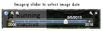
Figure 2. The Image Selector Tool in Google Earth.
When you click on the “Data Path” icon a data window opens like the one shown in Figure 3. A special cursor will appear that you can then use to click on the centers of boat slips. Their latitude and longitude coordinates will be recorded. When done save the file, in kml format.
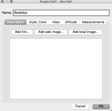
Figure 3. The Data Window that Records the Cursor Clicks.
Once you have a kml file with the data, you can extract the data manually by just ignoring all of the XML tags, or one can download and use well, as shown in Figure 4, where I also selected a conversion to UTM coordinates, and actually the Eastings and Northings for MD.

Figure 4. The Output from 'KML Translator.'
To check this small subset boat slips they are plotted over our existing ones, but first let’s look at some images to see which one to use.
Figure 5 shows the section from which the test subset was digitized. It’s at the height of the season, 6/2/2011. It’s an older image and not too terribly clear but boat slips are discernible. The red line is the path that is being recorded by Google Earth as I clicked on boat slips.
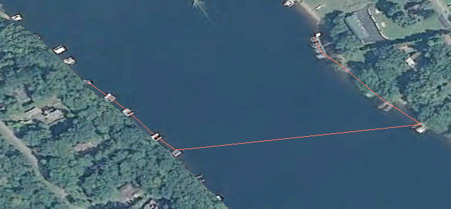
Figure 5. Boat slip subset on 6/2/2011.
There is much clearer, and much more recent imagery, namely on 11/12/2016, but, as can be seen, in Figure 6, most of the boatslips have been removed from the water and actually stored away from the lake, since they cannot be seen on shore.
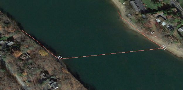
Figure 6. Boat slip subset on 11/12/2016.
Time of the year is important, as can be seen in Figure 7, and it can also be seen that, from year to year, boat slips are placed in pretty much the same place.
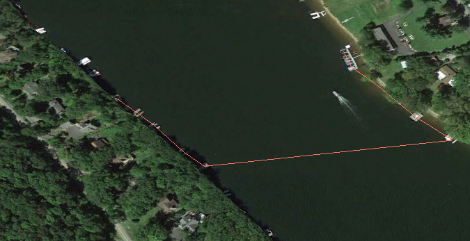
Figure 7. Boat slip subset on 9/5/2013.
The slip locations determined from the 9/5/2013 (Figure 7) imagery have been compared against the data that are in the 2011 file. The comparison is shown in Figure 8.
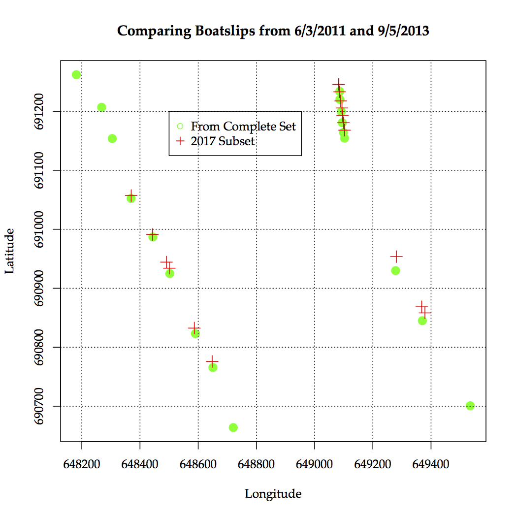
Figure 8. Comparing Boat Slip Locations.
The red trace shown in Figures 5-7 can be overlaid on any image to check for possible missing slips.
To conclude… The data set that I’m currently using is a pretty good approximation of the location of the boat slip. Perhaps some are missing, but overall [this should be a pretty complete set.]{{ < ref “/boatslips_/graphs/boatslips/BoatSlipsSPCS.txt” >}})
A map of the lake shoreline and the location of all of the 2012 computed boat slips is shown in Figure 9.
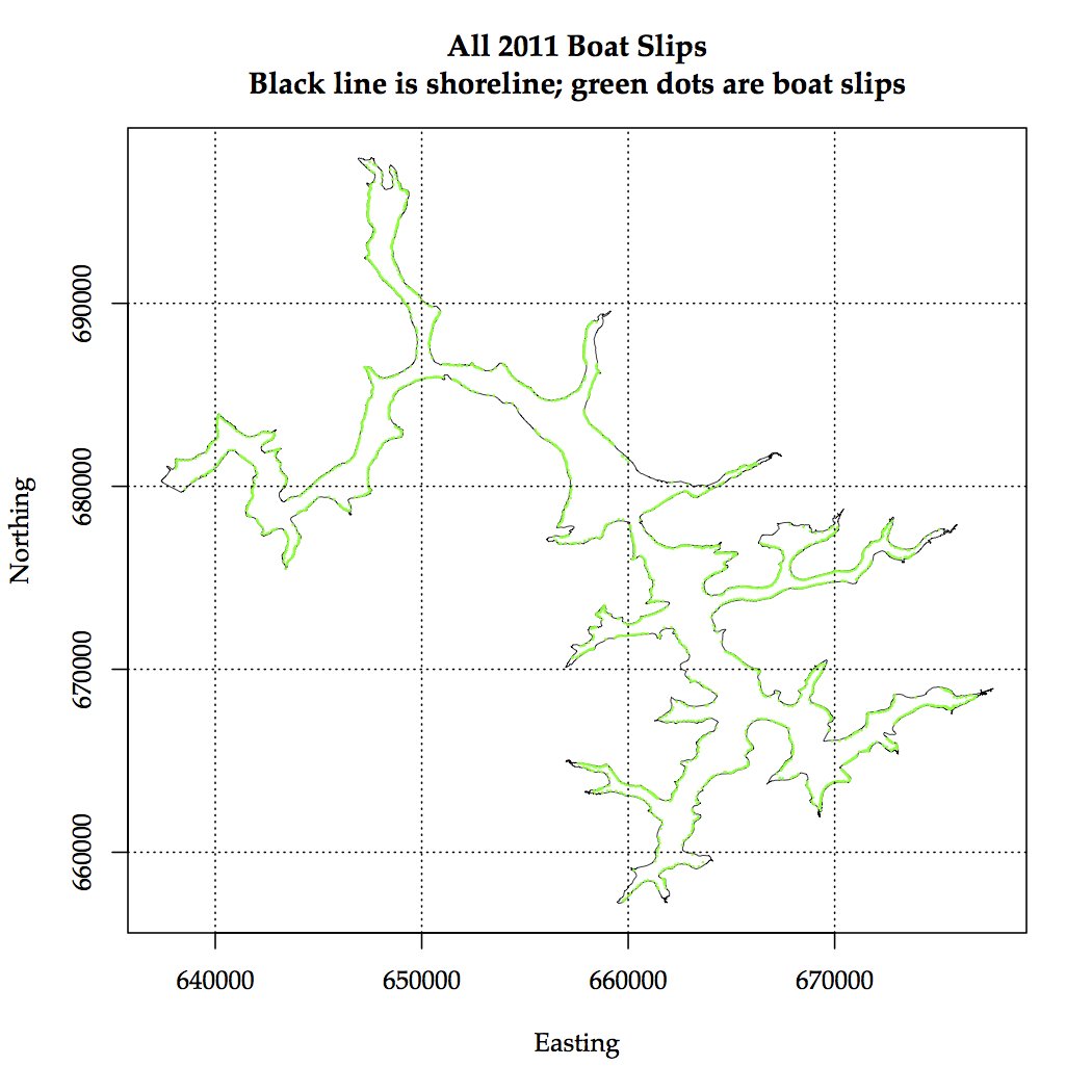
Figure 9. All Boat Slips Computed in 2012.